


st Guilhem étape 1

darranger
User

Length
24 km

Max alt
1256 m

Uphill gradient
492 m
Km-Effort
30 km

Min alt
1015 m

Downhill gradient
327 m
Boucle
No
Creation date :
2023-06-12 05:51:29.092
Updated on :
2023-06-12 13:07:32.001
5h41
Difficulty : Very difficult

FREE GPS app for hiking
 SityTrail
IGN / Geographical institutes
SityTrail Plus
The world is yours!
About
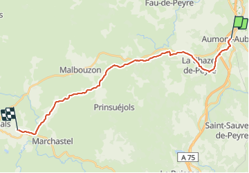
Trail Walking of 24 km to be discovered at Occitania, Lozère, Peyre en Aubrac. This trail is proposed by darranger.
Positioning
Country:
France
Region :
Occitania
Department/Province :
Lozère
Municipality :
Peyre en Aubrac
Location:
Aumont-Aubrac
Start:(Dec)
Start:(UTM)
522531 ; 4952202 (31T) N.
Comments